Feilding to Palmerston North
-
Walking
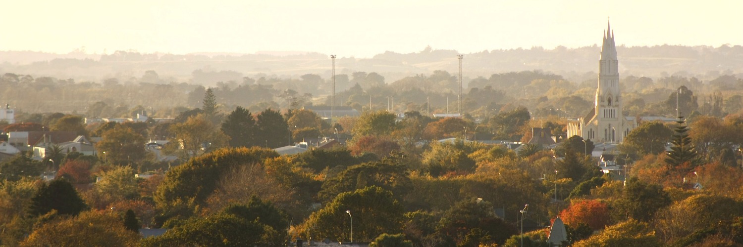
Te Araroa section: Make your way along shared paths, across rolling farmland and along quiet rural roads to the thru-hike halfway city of Palmerston North. At Palmerston North walkers are rewarded with art galleries, museums, cafes, restaurants and urban street art. Palmerston North is bordered by the Tararua and Ruahine mountain ranges and defined by Te Apiti – the Manawatū Gorge.
Feilding to Bunnythorpe — 9km / 2-2.5 hours
- Continue along South St for 1.5km to Aorangi St /Waughs Rd (at the end of South St).
- Cross the road ahead and turn right onto Waughs Rd.
- Follow the shared footpath/cycleway for 1km. Cross the Oroua River bridge.
- Turn left at the next intersection. Cross the railway line then turn right (south) onto the Campbell Road footpath/cycleway.
- Follow Campbell Rd path for 4.5km with the railway line to your right. You will pass Feilding Aerodrome on your left. There are public toilets here if needed, about 50m inside the gate.
- Where the main road crosses the railway line, hikers must also cross over and turn left onto the quieter Waughs Rd.
- Follow Waughs Rd south for 1km to its end, with the railway line to your left.
- Climb two stiles and continue along a track outside the fence line. Go through the small gate and keep to the right down to the Mangaone Stream crossing. Take care crossing in wet weather.
- Continue left up the other side. After about 150 metres cross the small Jacks Creek and continue along the track until you reach Kairanga/Bunnythorpe Road.
- Do not go straight ahead (it is a very busy highway between Bunnythorpe and Palmerston North), but turn left, cross the railway line and then turn right into the village of Bunnythorpe which has toilets and a dairy.
Bunnythorpe to Napier Rd, Palmerston North – 7.5km / 1.5 - 2 hours
The footpath through Bunnythorpe passes the old Glaxo factory. GlaxoSmithKline, one of the top 10 pharmaceutical companies in the world, had its genesis here in Bunnythorpe in 1904.
- South of the village, turn right into Stoney Creek Road.
- After 150m, cross the stile on your right and follow the marked trail south, across paddocks, to the Clevely Line/Sangsters Rd intersection.
- Head south along Sangsters Rd, with the railway line to your right. At the end of the road, climb over the stile and follow the marked trail across farmland and along farm driveways until reaching the Roberts Line/Railway Rd intersection.
- Cross the railway line at Roberts Line, turn left onto Railway Rd and follow the shared path towards Palmerston North.
- Keep left at the roundabout, cross the bridge over the railway line and continue straight ahead through the traffic lights onto Vogel St.
- There is a toilet available for public use in the branch library, 25m down Kipling St, at the start of the small Roslyn shopping centre.
- Continue along Vogel Street, on the left, for 1.5km.
- Take the sealed path down into the old cemetery. When inside the cemetery, turn left and follow one of the paths to the main gate. Exit onto Napier Rd.
- Cross Napier Road.
- For a short route into Te Marae o Hine (The Square) in the city centre, you can take a 104 or 114 bus at 100 Napier Rd opposite the cemetery.
- To continue on the trail, turn left (east)
Napier Road to Fitzherbert Ave Bridge – 7.5km / 1.5 hours
- After crossing the road from the cemetery exit, turn left (east) on Napier Rd and follow the footpath 500m to the start of the shared walkway beside the Gas Works Drain.
- Follow the shared path for 1.5km, from the Napier Road entrance down to the Manawatū River where it connects with the main Manawatū River shared path along the edge of the city.
- Turn right and follow the river path downstream for 5.5km until you reach the Fitzherbert Ave road bridge which crosses the Manawatū River.
- At the Fitzherbert Ave bridge, you can leave the trail and take a 2km diversion north into the city centre.
Conditions
Potential Hazards:
- Vehicles on road or track. Stay as far off the road as possible
- Track exposed to sun, wind or cold
- Few water sources
How to get here
Northern Start: South Street, Feilding
Southern End: Fitzherbert Avenue Bridge, Palmerston North
Transport
- Air New Zealand - Palmerston North Airport - Airport Drive, Milson P: 0800 737 000
- InterCity Buses arrive/leave from The Square
Rail
- Capital Connection – Weekday service to/from Wellington
- Northern Explorer Tourist scenic service to/from Auckland or Wellington
Trains Depart from Train Station - Off Tremaine Avenue, Palmerston North
Local transport
- Palmerston North Bus services – Arrive/depart from Main St, near The Square, Palmerston North
Accommodation
- Whiowhio Hut - Palmerston North (close to the Manawatū River Shared Path). Please phone or text before arrival. P: 027 470 9829 - E: whiowhiohut@swampthing.co.nz Urban tramping hut. Kitchen, shower, laundry, bikes and even electricity. Payment by koha (donation). Hosted by Te Araroa walkers, Te Araroa Manawatū Trustees, and Whio (native blue duck) enthusiasts Anthony and Fiona (a.k.a. Whin and Whiona).
- Feilding Trail Angels Abby, Tim and daughter Eleanor offer space on their front lawn for tents and/or a comfortable bed in their sleepout, showers and laundry etc. Stay 1 night or several if you need to recharge. Can potentially pick up/drop off between Whanganui and Palmerston North. Koha welcomed in the form of conversation over a shared meal (usually based on produce from their garden) or a bit of help around the house/garden. Please arrange in advance if possible. abbykerrin@gmail.com or 021 774 864
- David and Margaret in Feilding. We can offer tenting space on our lawn and access to our home for shower, spa pool, laundry / drier and a cooked meal. In inclement weather, we may be able to find some floor space. Maximum 2 people. May be able to pick up and shuttle between Whanganui and Palmerston North. M: Dave 027 588 8098 E: drm1952@hotmail.com
- Palmerston North Holiday Park. 133 Dittmer Drive (off Ruha St) Palmerston North. P: 06 358 0349 E: palmerstonnorthholidaypark@xtra.co.nz https://palmerstonnorthholidaypark.co.nz/
- Local accommodation businesses
Food And Supply
- Pak N' Save - 327 Ferguson St, Palmerston North
- Countdown - Cnr Ferguson and Ashley St, in the Plaza
- New World Melody’s Supermarket - 299 Broadway Ave
- Bin Inn – 688 Main St
- 4 Four Square - 354 Albert St, Hokowhitu
- New World Aokautere, 198 Ruapehu Drive
Resupply options for the Tararua Ranges are in the next section of the trail notes.
Track Elevation and Map

Total 1 photos. Click image above to view them all.
More information
- Palmerston North City i-SITE - Te Marae o Hine - The Square, Palmerston North - P: 06 350 1922 or 0800 626 292
- DOC Te Papaioea/Palmerston North Office – 28 North Street, Palmerston North - P: 06 350 9700
Before starting Te Araroa either as a through-walker of the whole country or a section walker, please register on Te Araroa website. Please also visit the website or download the app for detailed maps, trail alerts and other relevant information.
This track is part of the Herenga ā Nuku Aotearoa track database. Herenga ā Nuku has maps and advice about public access to the outdoors.
We encourage you to continue gaining the skills and knowledge required for a safe trip. The NZ Mountain Safety Council has lots of free resources and information you can use. These can be accessed via www.mountainsafety.org.nz.
We recommend trying these online learning tools:
Additionally, check out the range of helpful videos available from the NZ Mountain Safety Council YouTube channel.


